Grand Canyon

Slide Show

Grand Canyon and nearby

September 2021

comments

Back to Miscellaneous Photos

To contact me: Click Here

Click on any photo to see a larger version...


The Ride Out

Mostly along I40

202109171310_DSCN2802.jpg
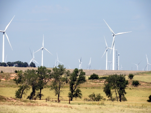
wind turbines in Missouri
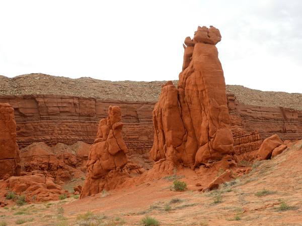
202109181412_DSCN2808.jpg
the long road west
202109181457_DSCN2814.jpg
dinosaur bones near Moenave, AZ
202109181501_DSCN2815.jpg
dinosaur tracks near Moenave, AZ

North Rim

Grand Canyon North Rim, at south edge of Kaibab National Forest

202109191125_DSCN2857n8.jpg
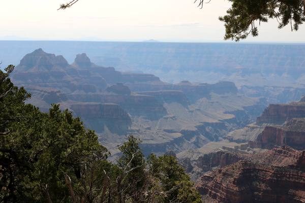
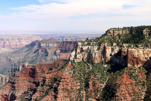
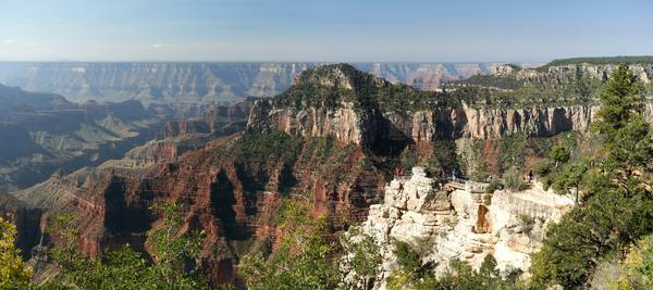
views from the North Rim, near Kaibab Lodge
202109191401_IMG_0823.jpg
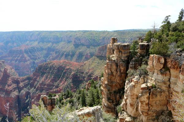
along the Transept Trail
202109191410_IMG_0826.jpg
202109191412_IMG_0827.jpg
George and Nancy Kierspe
202109191429_IMG_0831.jpg
a deer along Transept Trail
202109191503_IMG_0844.jpg
202109191518_IMG_0847.jpg
202109191521_IMG_0850.jpg
202109191523_IMG_0852.jpg
202109191536_IMG_0854.jpg

Cape Royal Road

Some spectacular views

202109201449_IMG_1164.jpg
Young aspens (yellow) are first to grow back after a fire (will eventually be replaced by pines)
202109201620_IMG_0856.jpg
202109201622_IMG_0858.jpg
202109201622_IMG_0859.jpg
202109201623_IMG_0862.jpg
202109201623_IMG_0864.jpg
202109201717_IMG_0876.jpg
202109201718_IMG_0877.jpg
202109201749_IMG_0890.jpg
Angel's Window
202109201801_IMG_0898n9.jpg
202109201802_IMG_0900.jpg
202109201802_IMG_0901.jpg

Vermillion Cliffs

202109211232_DSCN2869.jpg
202109211236_DSCN2872.jpg
202109211242_DSCN2874.jpg
202109211248_DSCN2879.jpg

ATV Tour

Rode out to some of the more remote spots (White Pocket) on ATVs, on trails only passable by 4x4, high clearance vehicles (in this case, Polaris ATVs)

202109221237_IMG_0946.jpg
202109221239_IMG_0948.jpg
202109221239_IMG_0949.jpg
202109221341_IMG_0958.jpg
202109221342_IMG_0962.jpg
202109221353_IMG_0964.jpg
202109221359_IMG_0965.jpg
George
202109221408_IMG_0968.jpg
202109221411_IMG_0970.jpg
202109221419_IMG_0972.jpg
White Pocket
202109221421_IMG_0973.jpg
202109221421_IMG_0975.jpg
202109221426_IMG_0979.jpg
Shield shrimp: their eggs can lay dormant and dry for years, then hatch when rain falls
202109221428_IMG_0982.jpg
202109221429_IMG_0984.jpg
202109221434_IMG_0986.jpg
202109221802_IMG_1205.jpg
202109231016_IMG_1190.jpg
202109231016_IMG_1202.jpg
202109231016_IMG_1206.jpg
a victim of fire

Slot Canyons

Lower Antelope and Cathedral canyons: These "slot canyons" are formed by water rushing through and cutting into the soft sandstone. They get flash floods in the area, and they (it's on Navajo land) do not allow access during any chance of rain... tourists have been drowned by unexpected flooding rushing through

202109260017_IMG_1260.jpg
202109260017_IMG_1263.jpg
202109260017_IMG_1266.jpg
202109260017_IMG_1272.jpg
202109260017_IMG_1275.jpg
202109260017_IMG_1277.jpg
202109260017_IMG_E1264.jpg
202109260017_IMG_E1266.jpg
202109260017_IMG_E1267n8n9.jpg
202109260017_IMG_E1272.jpg
202109260017_IMG_E1275.jpg
202109260115_IMG_1232.jpg
202109260115_IMG_1233.jpg
202109260115_IMG_1236.jpg
202109260115_IMG_1240.jpg
202109260115_IMG_1243.jpg
202109260115_IMG_1250.jpg
202109260115_IMG_1252.jpg
202109260115_IMG_1257.jpg
202109260115_IMG_1259.jpg
202109260115_IMG_1261.jpg
202109260115_IMG_1265.jpg
202109260115_IMG_1271.jpg
202109260115_IMG_1273.jpg
202109260115_IMG_1274.jpg
202109260115_IMG_1278.jpg
202109260115_IMG_1279.jpg
202109260115_IMG_1281.jpg
202109260115_IMG_E1273.jpg
202109260115_IMG_E1284.jpg

Horseshoe Bend

Easily one of the most photographed spots on the planet, near Page AZ

202109272039_IMG_1304.jpg
HorseshoeBend.jpg
HorseshoeBend.jpg

Homeward

202109260807_DSCN2944.jpg
Early morning sunrise
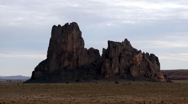
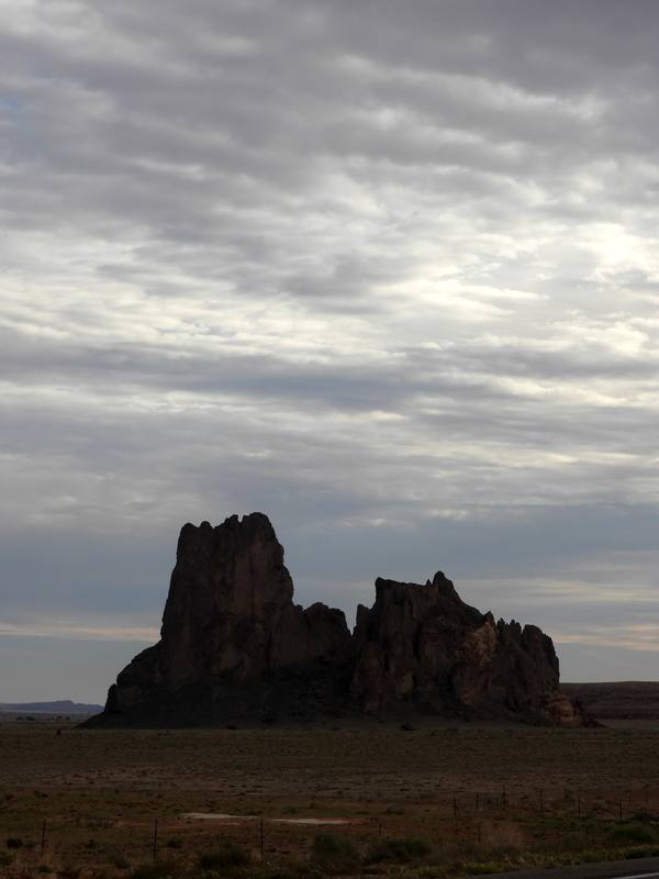
202109260935_DSCN2945.jpg
202109260935_DSCN2946.jpg
202109260951_DSCN2953.jpg
202109260952_DSCN2955.jpg
202109261120_DSCN2956.jpg
Shiprock Peak
202109261120_DSCN2960.jpg
202109271401_DSCN2968.jpg
wind turbines in Texas... there are lots

Sante Fe

Only got to stop in Santa Fe for one Sunday afternoon. Shots are from the New Mexico Museum of Art

202109272039_IMG_1294.jpg
202109272039_IMG_1296.jpg
202109272039_IMG_1298.jpg
202109272039_IMG_1299.jpg